Tuesday 8th – Sunday 13th, Nov.
The evening I arrived in Puerto Natales I bumped into a backpacker from Sweden who I’d met on the boat, he was out with a group from his hostel so I joined them for dinner. Everyone there was at different stages of either preparing or returning from the treks in the Torres del Paine national park. I learned from them everything I needed to know about the possible routes; there was the 4 day ‘W-trek’ which took in the southern valleys of the park or the 10 day ‘O-trek” which looped around the north, effectively joining the two ends of the W. I had heard much about needing to book the campsites beforehand (a complicated process as they are run by 3 different companies) but, not knowing when I would arrive I’d decided to try my luck. I was very much in luck, over dinner I met an owner of a hostel in town and he told me to come round in the morning and he’d walk me through the process and see if I could get a last minute place.
Late the next morning I cycled round to his hostel and within half an hour, standing in front of a giant map of the national park, I had a route planned along the ‘W’ and three campsites booked, starting the next day and for the grand total of $65. I learned to be careful who to mention this to as many people book months in advance and for a much steeper price. The rest of the day I spent running around town for supplies and a bus ticket for the two hour drive north the next morning.
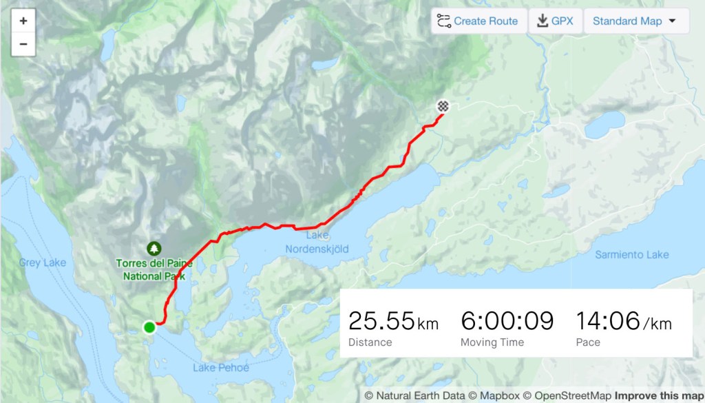
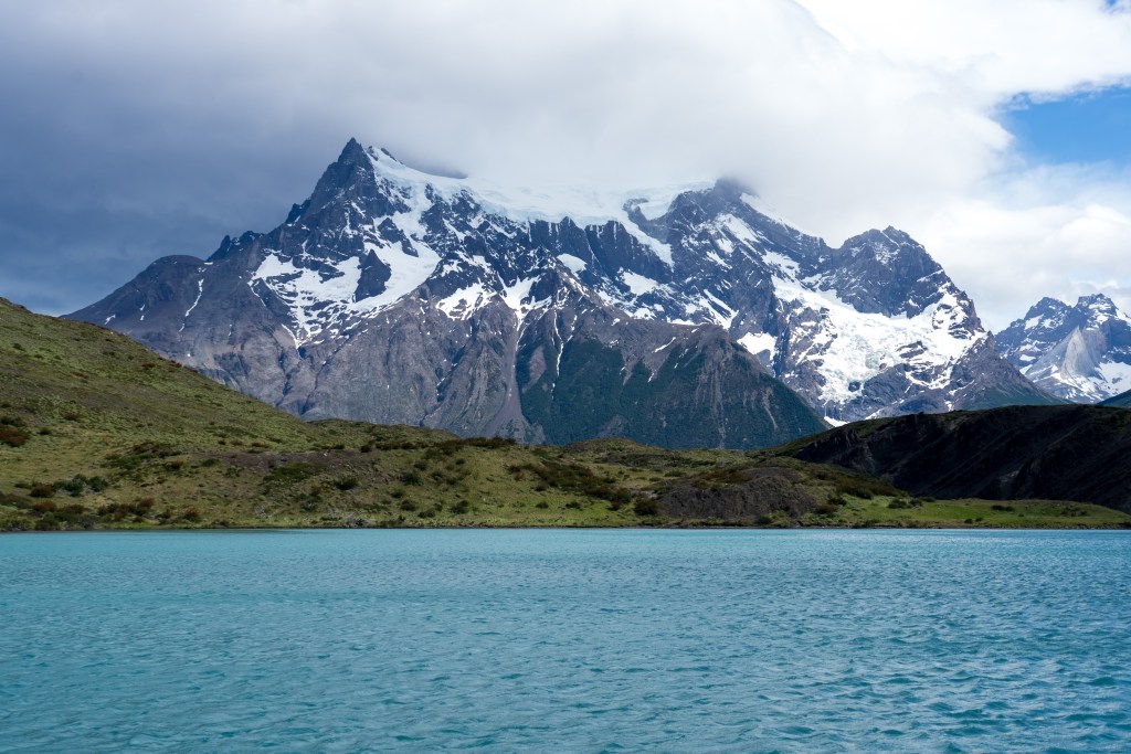
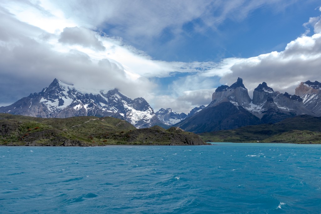
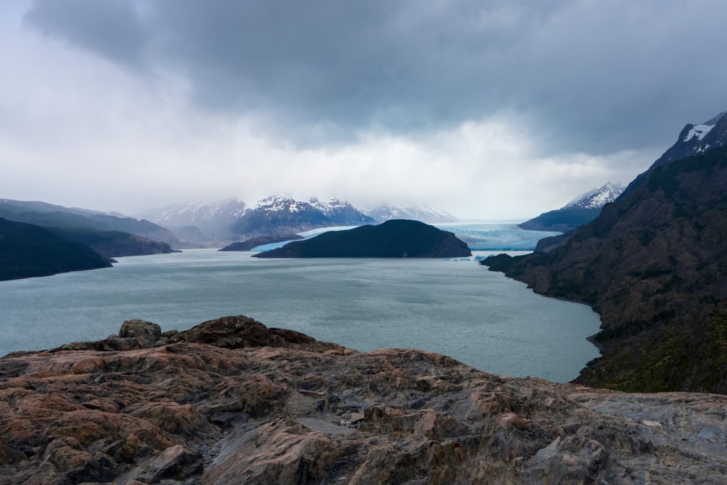
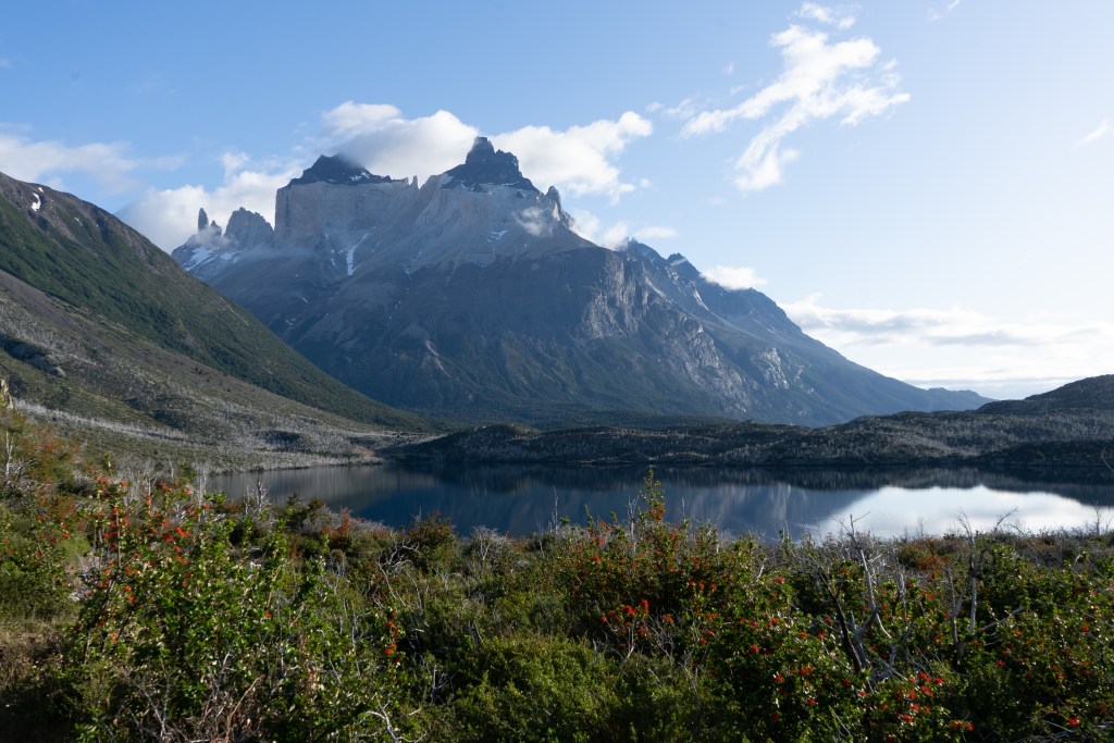
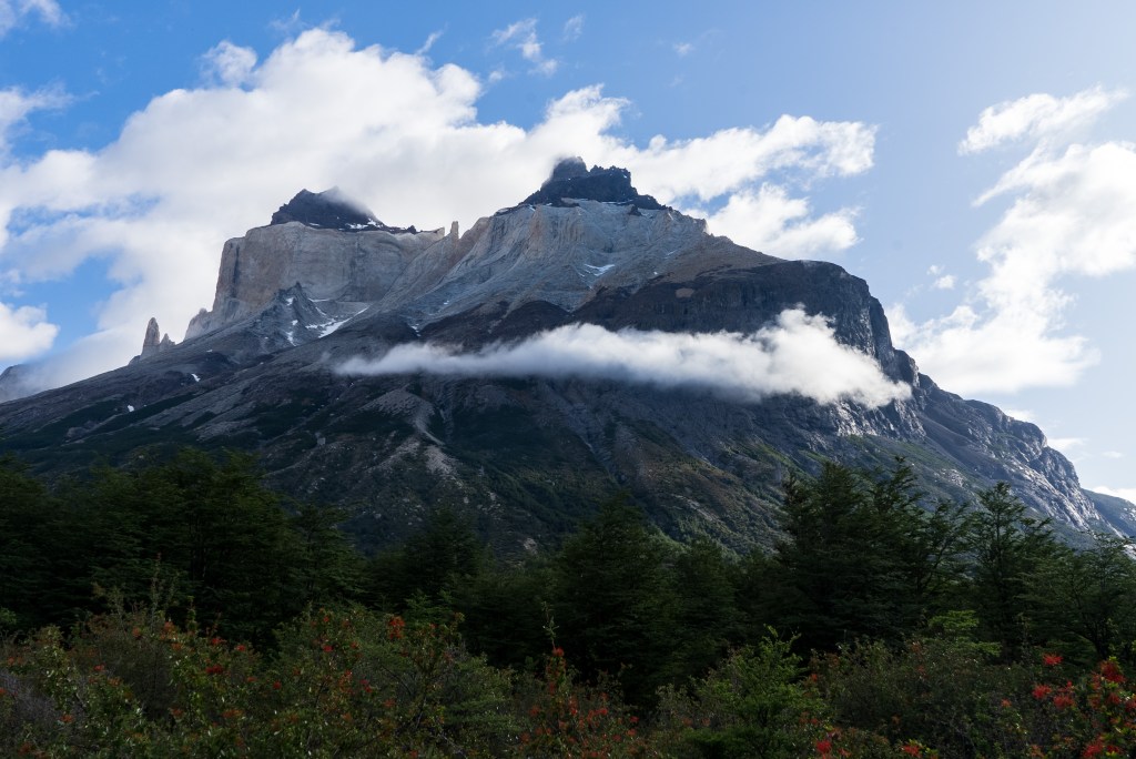
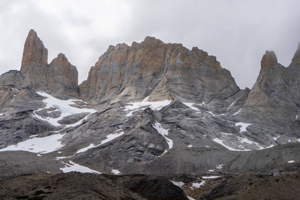
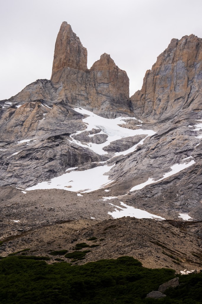
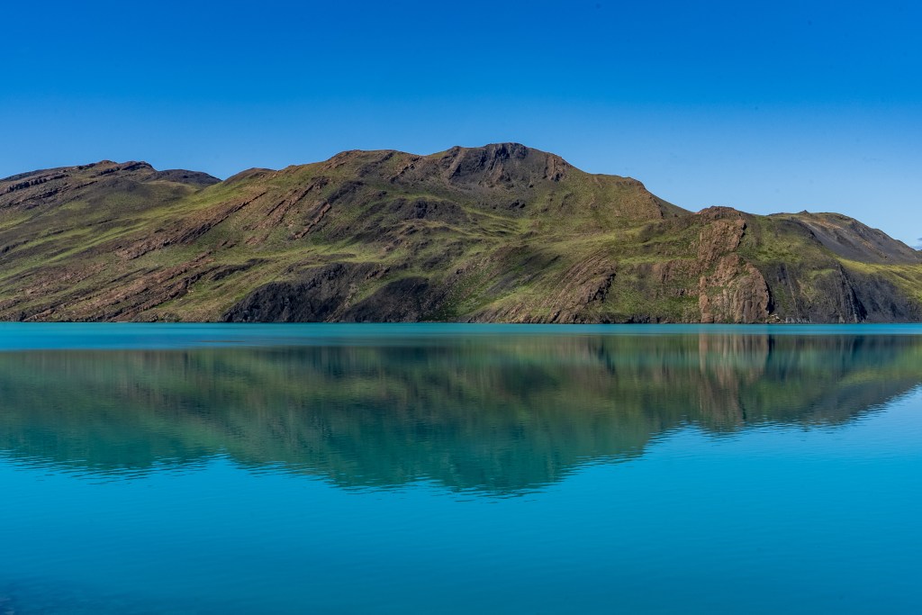
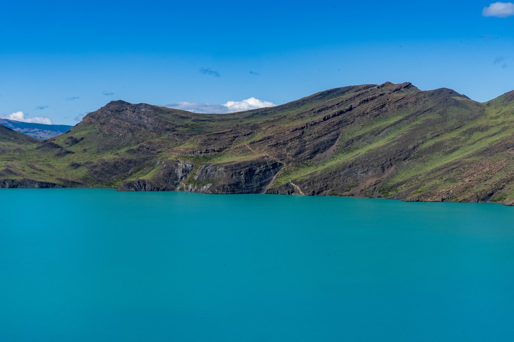
I packed what I needed and left the rest, including my bike, at the campsite and caught the early bus. It dropped me at a small pier on the edge of Lago Pehoe from where a boat took 50 or so hikers westward across the lake to the first campsite. The ‘W’ is named so for the shape of the route it takes around two mountains. If you imagine two peaks making up the downward empty space in the W and the lines of the letter representing the valleys between them. The first campsite of Paine Grande sits at the bottom-left point of the W. I’d be spending two nights there, hiking return trails to the to the top-left and the centre point. The third day would be crossing to the bottom-right point and the final day up to the famous towers at the top-right.
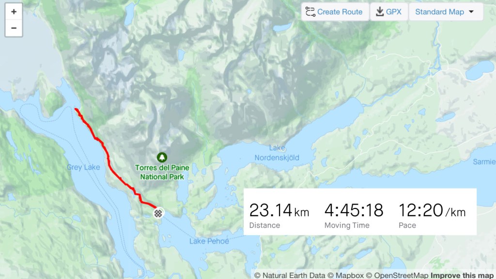
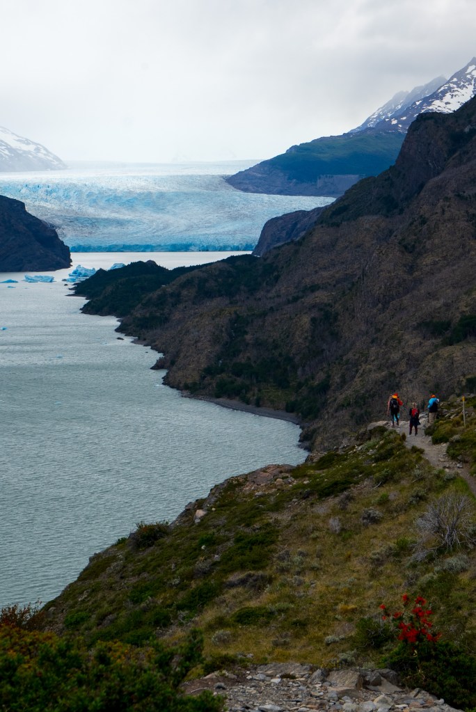
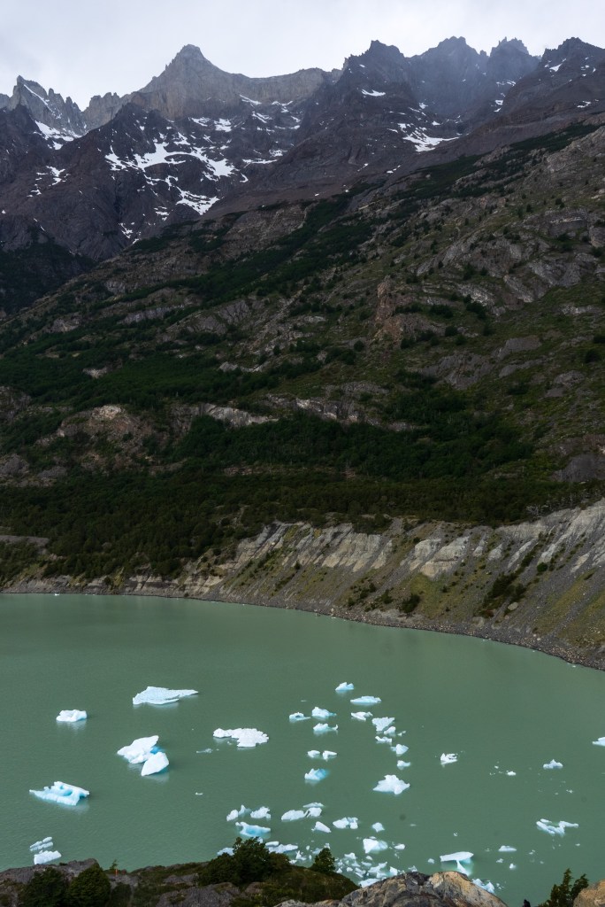
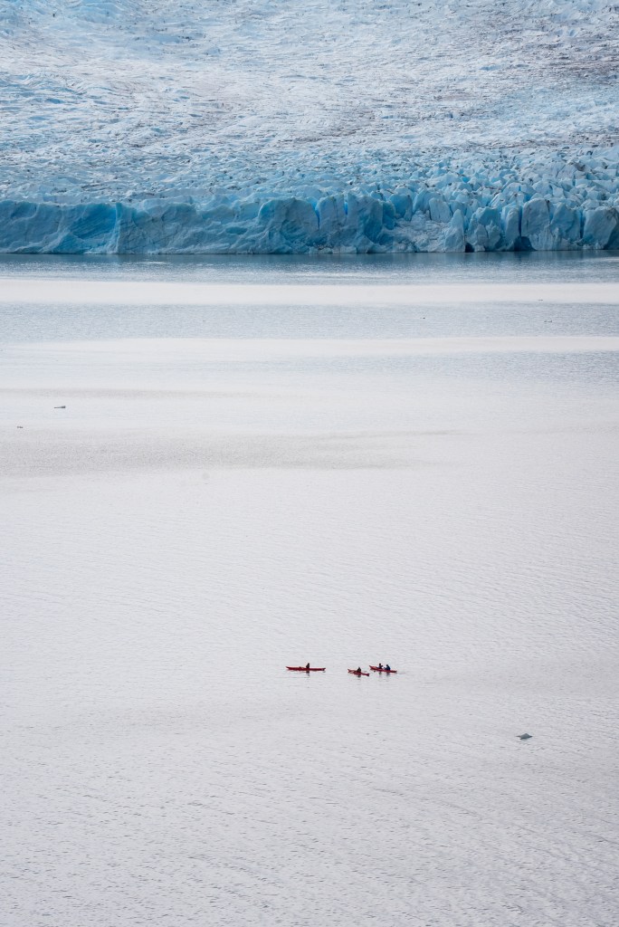
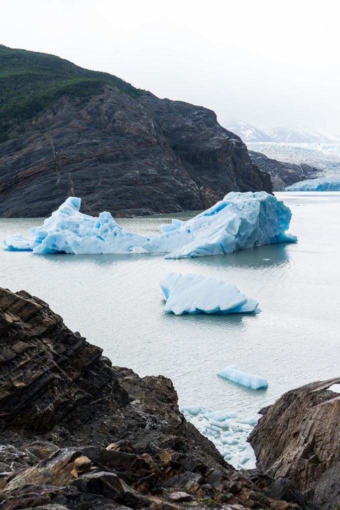
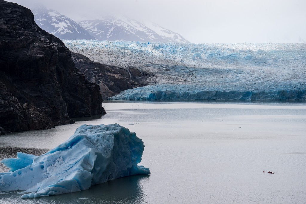
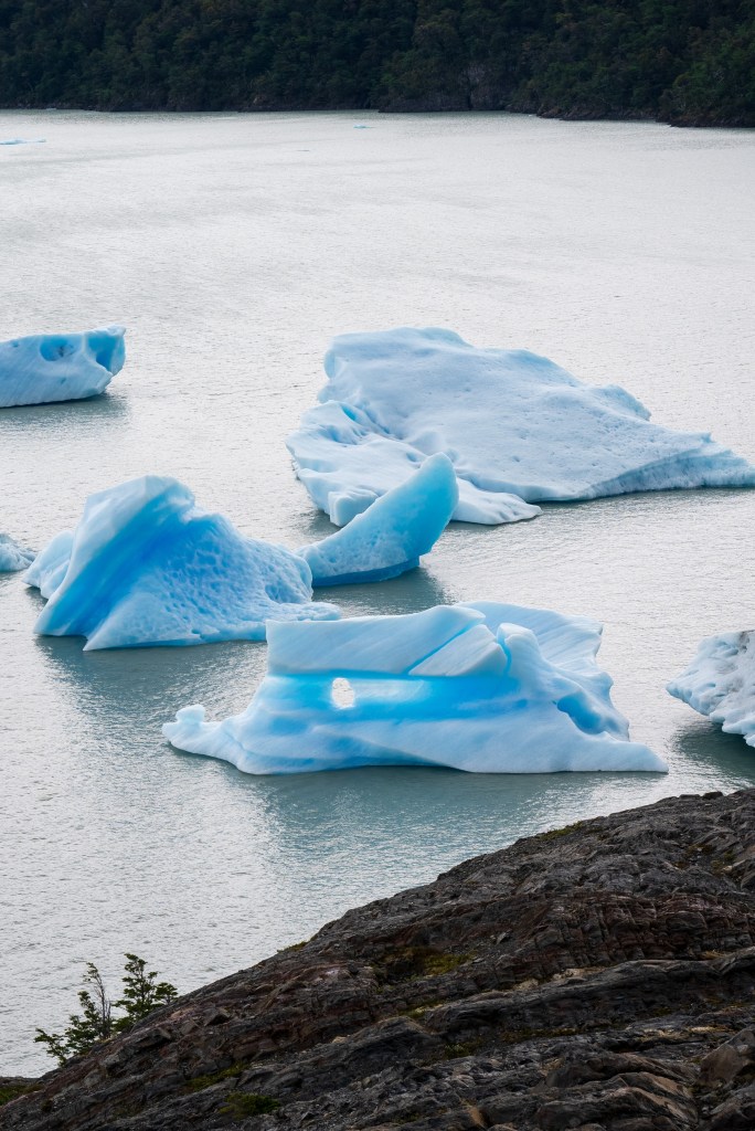
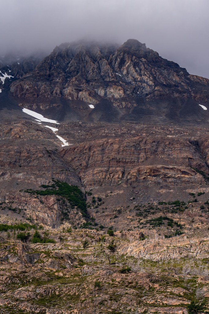
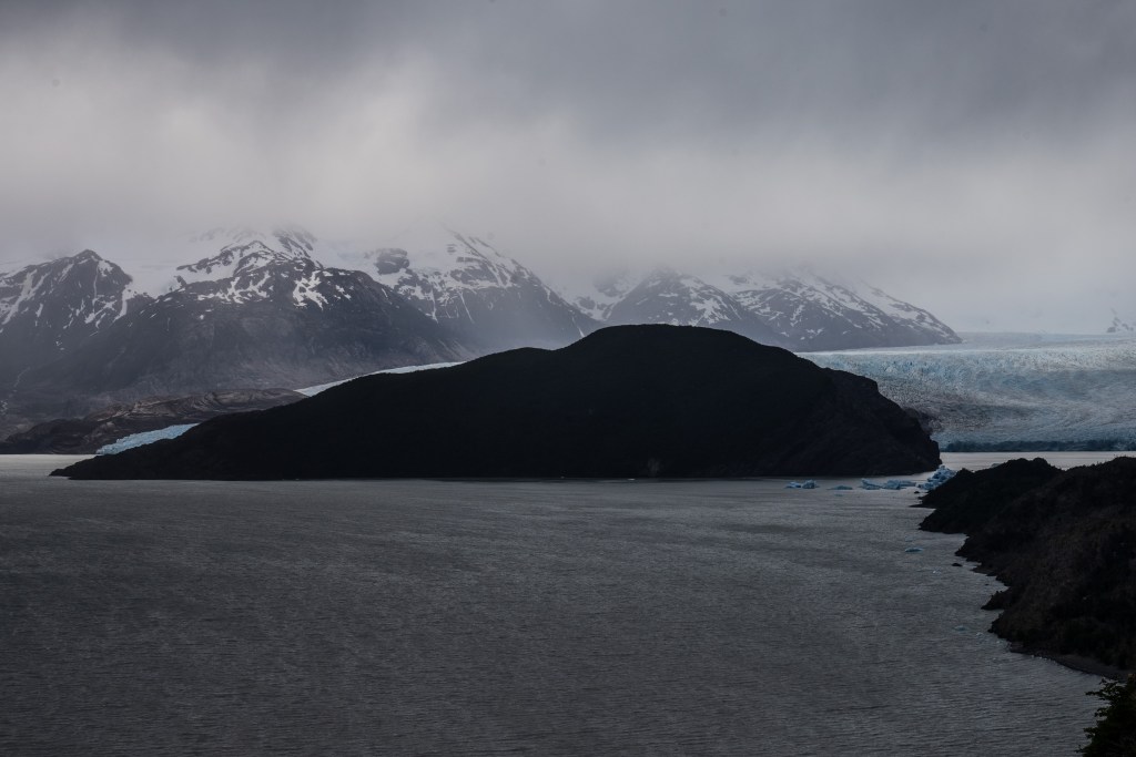
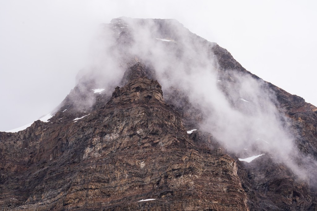
I arrived at around midday and set up my tent and packed a day-bag before heading up the left leg towards the Grey Glacier. It was an overcast day with a strong wind and patches of rain, which didn’t hinder the hike but the clouds sweeping over the peak to my right gave an ominous look to the rugged mountain. Lago Grey stretched up along to my left and before long small blue icebergs could be seen floating down from the yet unseen glacier. The route was pretty busy, people heading with me from the boat clambered upwards and more than a few exhausted looking faces headed downwards; “O-trekkers” on their final day. Up and down through silver forests and across a few streams I walked with a fast pace along the 11km path, knowing that I still had to return that day. When the glacier finally came into view the scale was astonishing. It was a wall of ice in the distance that stretched backwards and faded out of sight into a low white sky. Surrounding walls made a moody dark by the overcast light highlighted the bright ice even more. I passed through another campsite and headed to a viewpoint as close to the glacier as possible where I spent about half an hour sat looking out across the now massive icebergs that floated in front. A group of kayaks paddled behind the largest of the bergs and towards the glacier face, giving some sense of scale but still it was incomprehensible. Twice I heard a thundering crack echo down the valley as the ice shifted. Aware of time I started back the way I came, the route was now completely empty and I made a good pace back to camp where groups of hikers cooked and ate in a large communal hall.
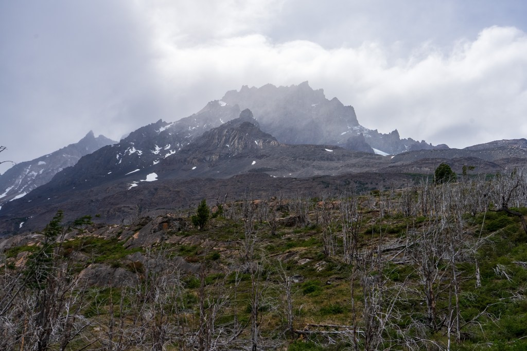
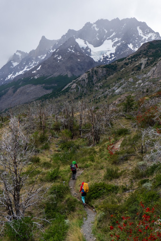
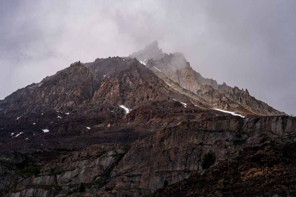
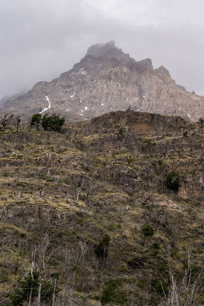
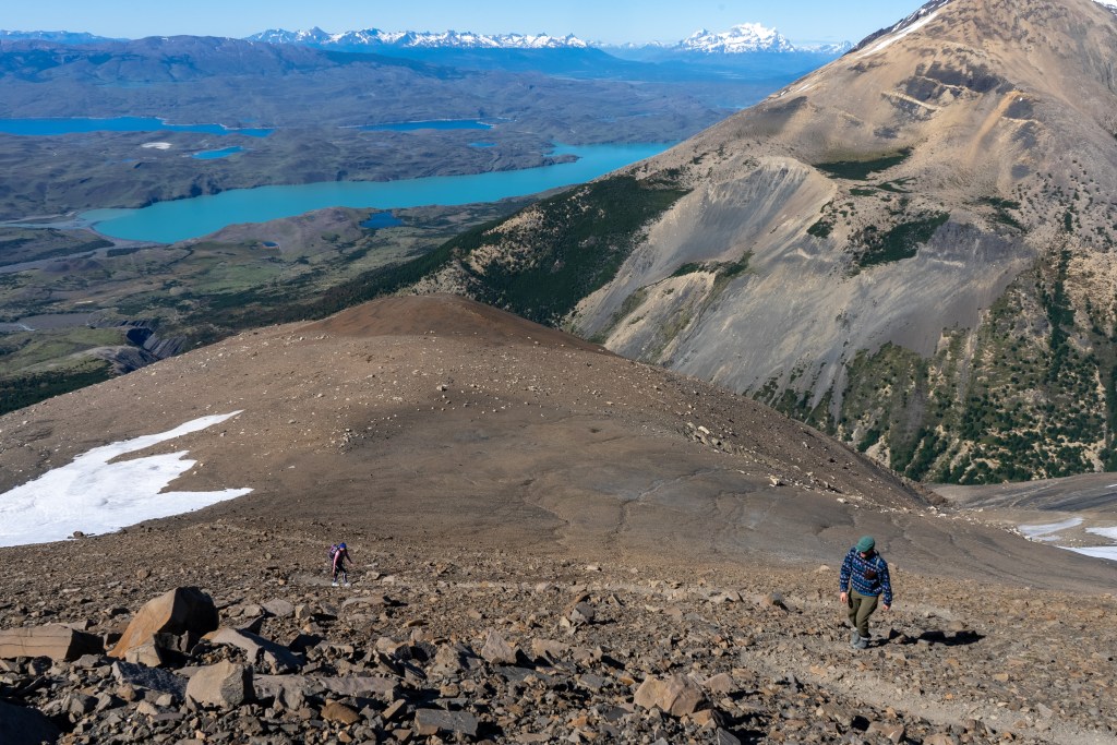
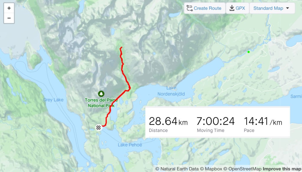
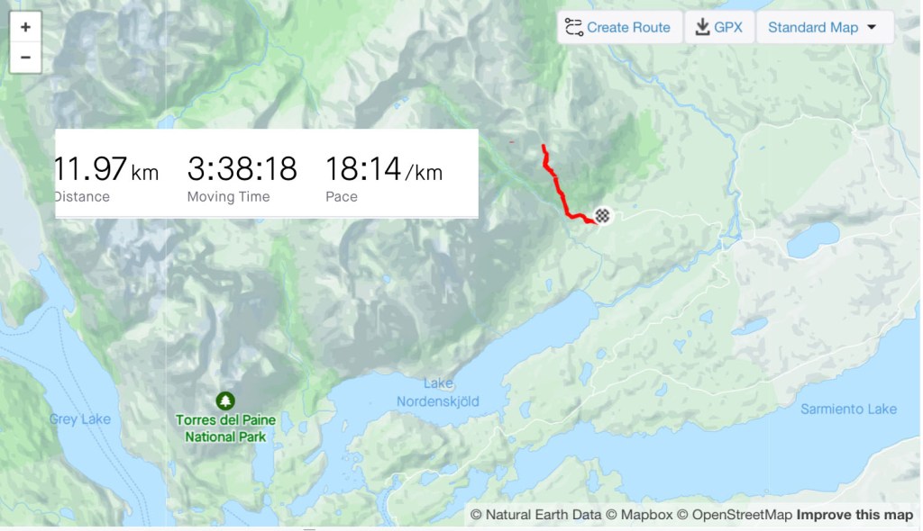
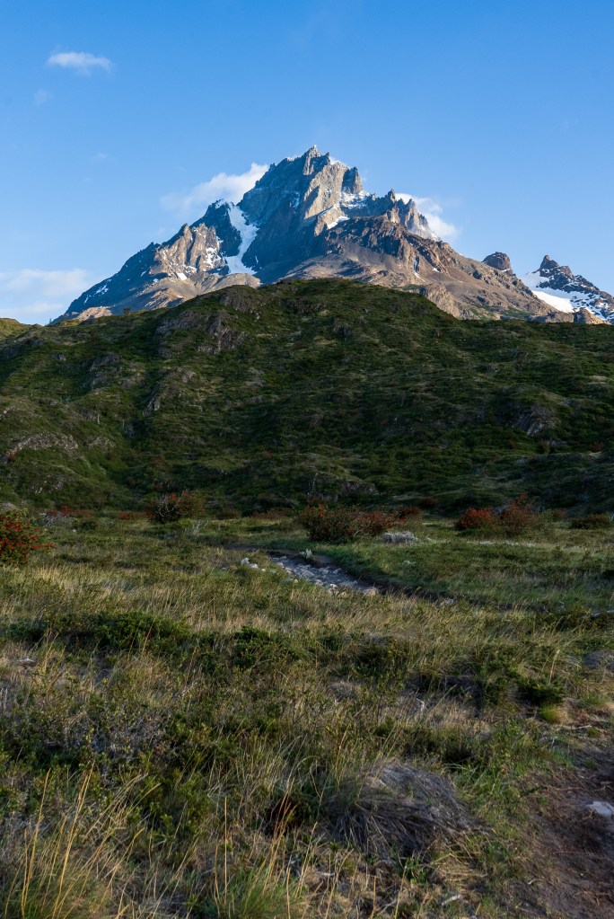
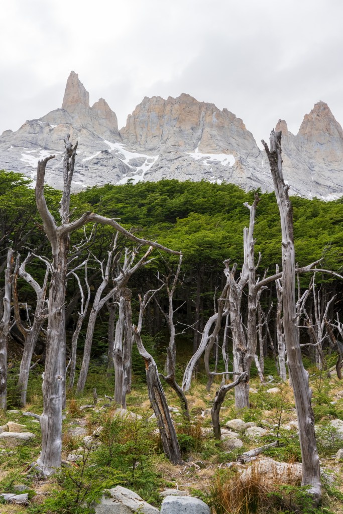
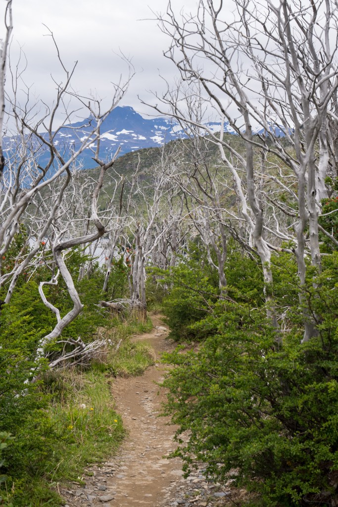
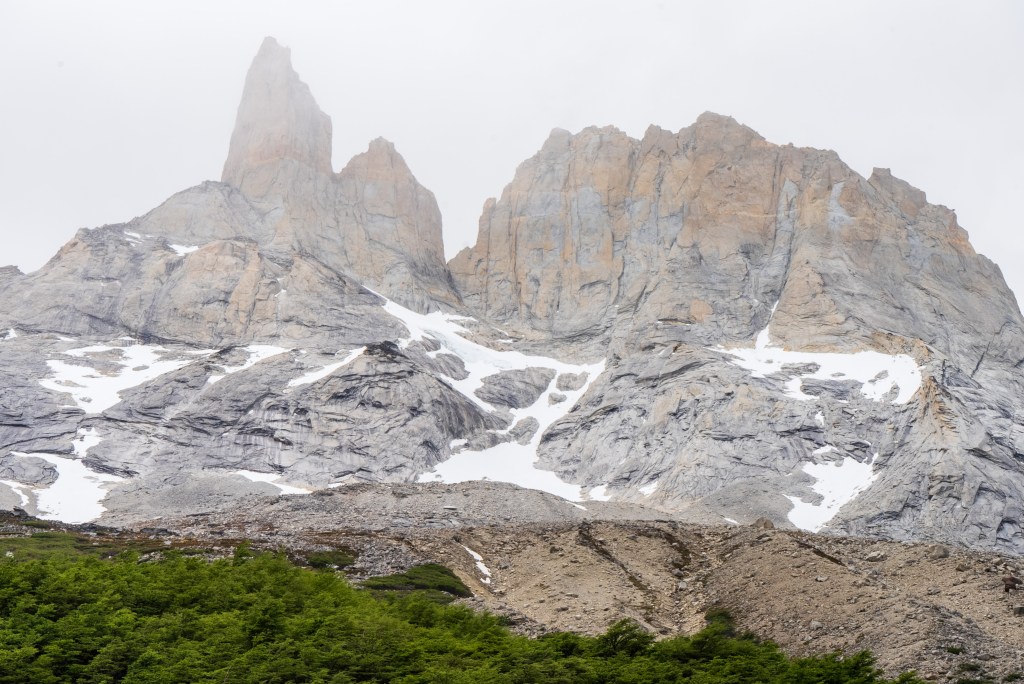
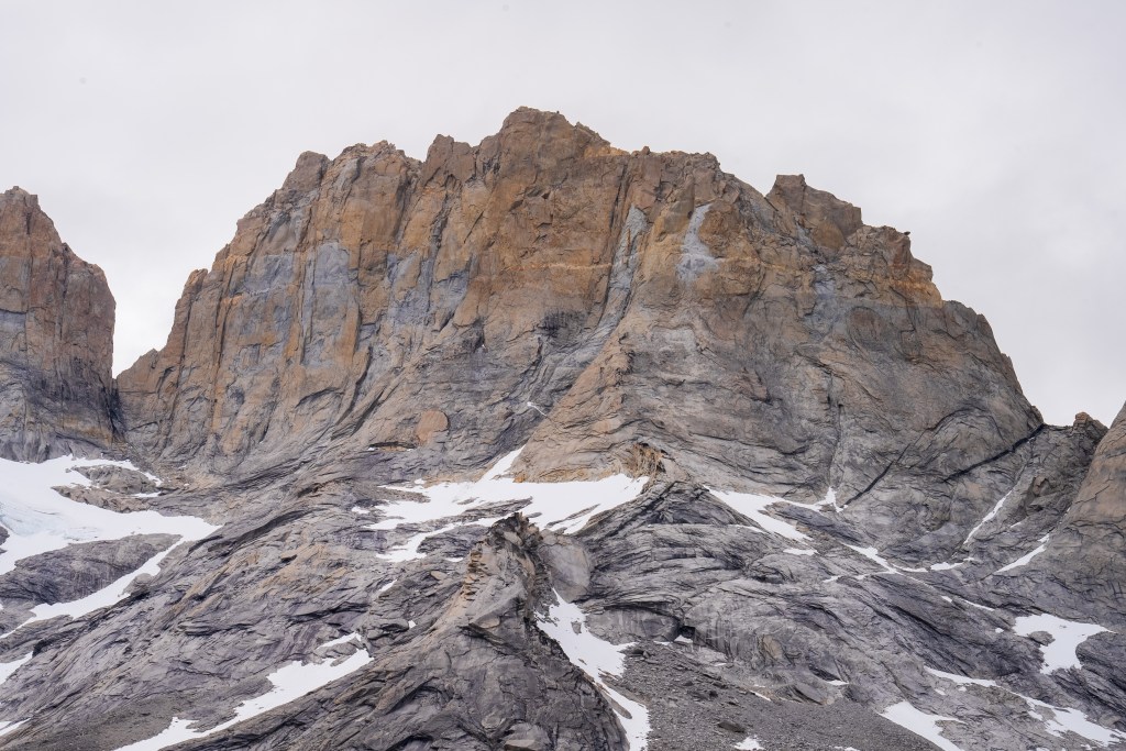
The next morning I was up early and one of the first on the trail. Today was to be my longest day, about 28km return trip but again I was with a day-bag not my full pack. I picked up two sturdy looking sticks and marched off to the north-east through the dead forest. In 2011 a wildfire was ignited by a hiker burning toilet paper, it spread across 40,000 acres of the park and took nine days to bring under control. The barren silver tree trunks in this sector of the park, killed but not burnt, still stand as an eerie reminder. Yesterday’s cloudy mountain stood on my left now and the second ridge came into view, I was aiming for the valley in between. The far side was beyond epic; a two-toned table-top castle of a mountain with vertical cliffs, clouds hanging off the face. I reached the entrance to the valley between the peaks and passed through two closed campsites. The park rangers were on strike so certain places were closed but one could still pass through. The rangers have been fighting poor working conditions and insufficient pay and their signs and black flags were everywhere. Unfortunately it felt that their position was a difficult one, the other campsites are run by private companies so much of the park’s revenue is channeled through them, the rangers don’t seem to have much bargaining power as they couldn’t close the park entirely. Even towards the towers, the park’s main attraction, where they were partly dismantling bridges, they couldn’t really enforce a closure beyond refusing rescue, their actions felt mostly symbolic.
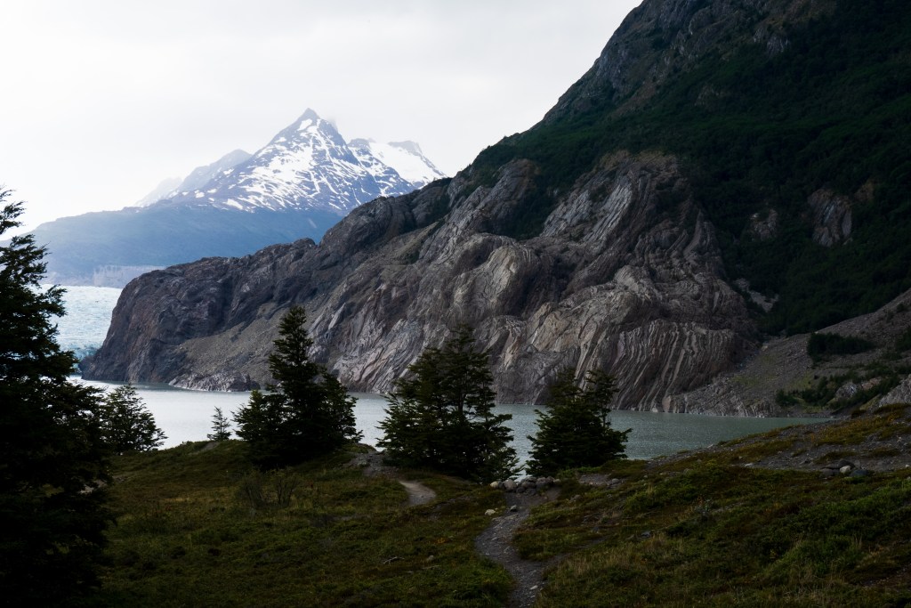
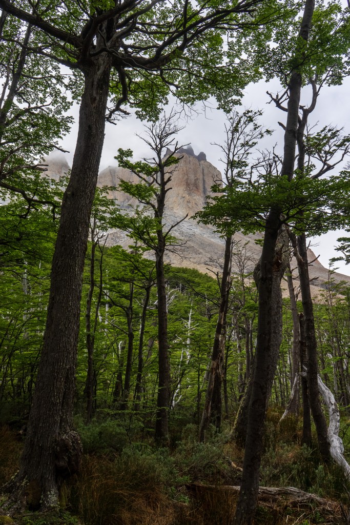
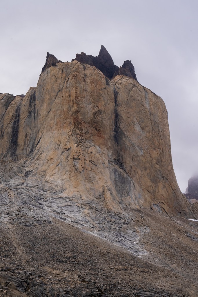
The central valley was green, untouched by the fire, and climbed steeply alongside a river fed by snow melting down the opposite face. Smaller ice fields hung steeply on ledges and fed snowdrifts below, the occasional avalanche sending impossibly loud echos down the valley. Through a dense forest where pumas are known to roam, one hiker I met actually had a video of one crossing the path, the trail opened up below the back of the towers. The final few hundred metres were a steep scramble to a view point where I rested a the top of the trail, the valley still climbed up towards the distant wall where the river began. The return journey gave a spectacular view out over the lakes towards the plaines in the south.
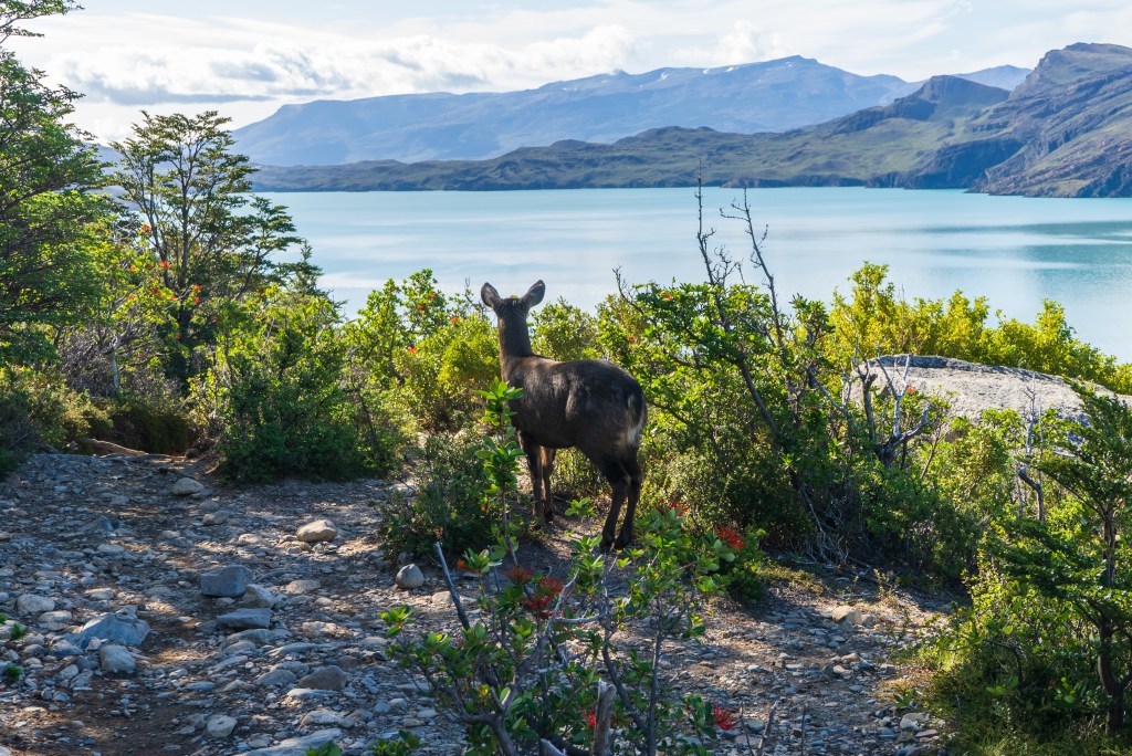
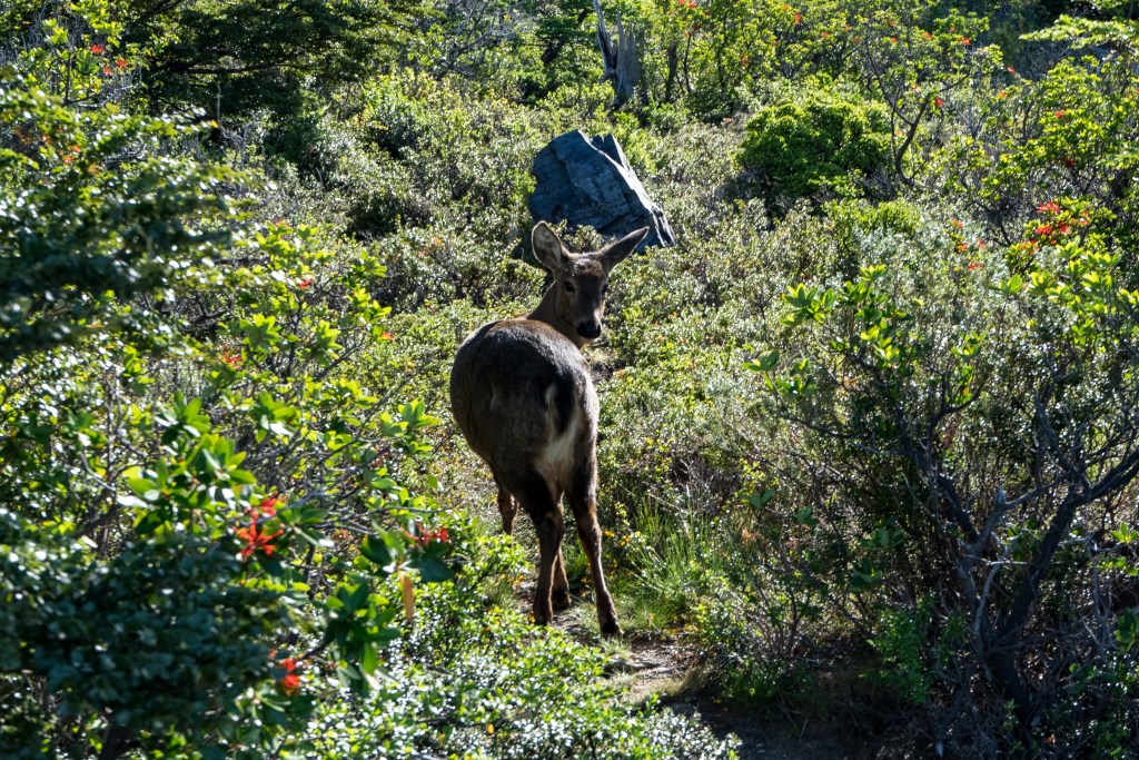
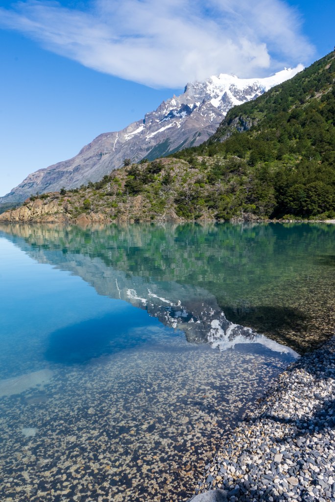
My third day was with a full pack, past the valley of the day before and alongside the southern lake. There was no extended climb but lots of up and down as I crossed the forest out onto the exposed eastern reaches. The path got narrow and the sun beat down all day. At one point I froze mid-stride as I saw a humeul, an endangered deer, looking out over the lake before trotting off into the forest. About half-way though the day the path dropped down to a beach of black and white pebbles leading into the clear blue lake. Without a moment’s hesitation I dropped my pack and walked into the water. It was ice cold and I lasted not even a minute before scrambling back to the beach and drying off in the sun, leaning against a log and making some lunch. The rest of the day was a sweaty slog through the dust with aching shoulders before reaching the final ridge where the land opened up and I could see the campsite in the distance. I pitched my tent under the shade of a tree and spent the evening with friends from the boat and planned the next day’s hike to the towers.
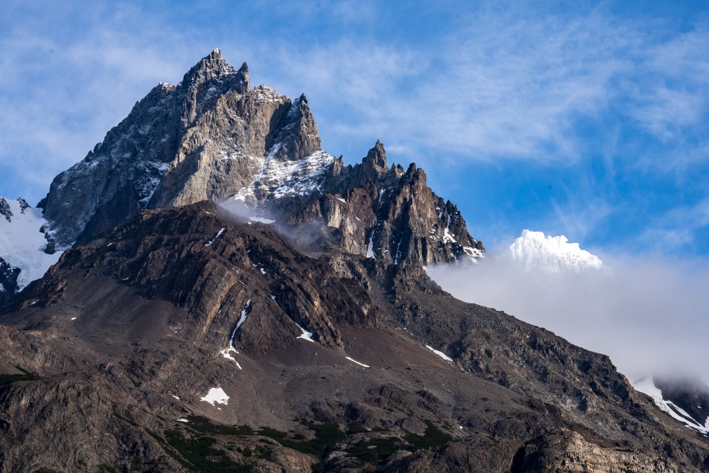
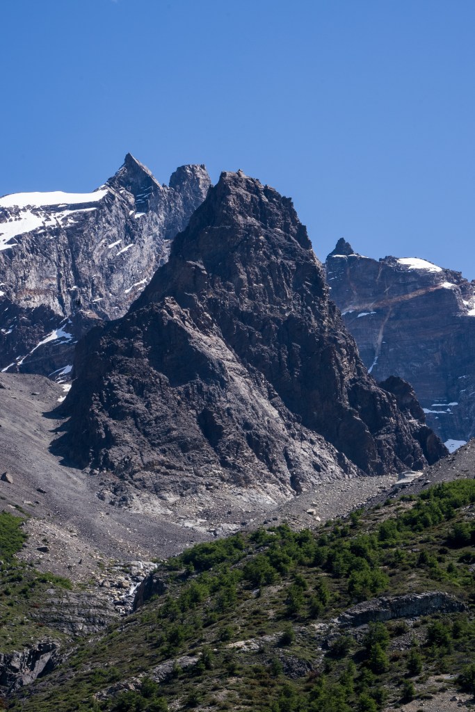
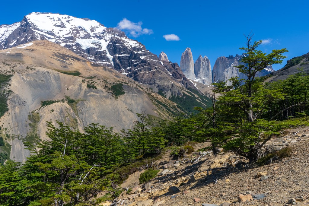
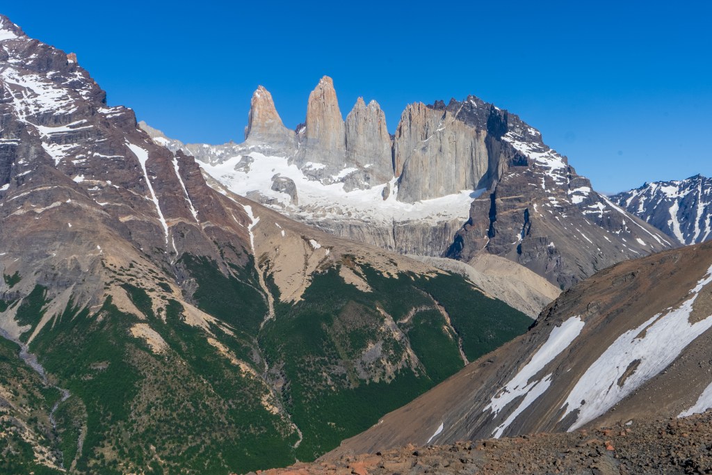
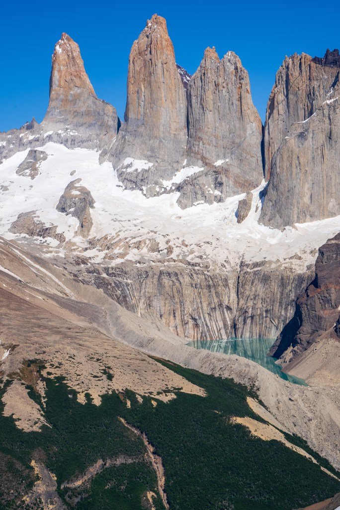
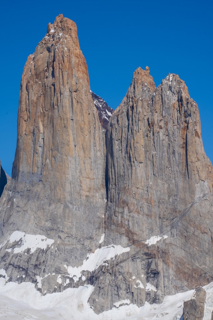
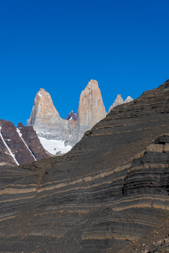
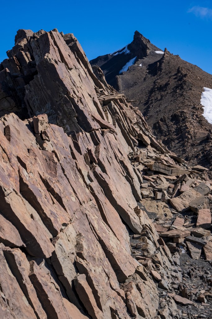
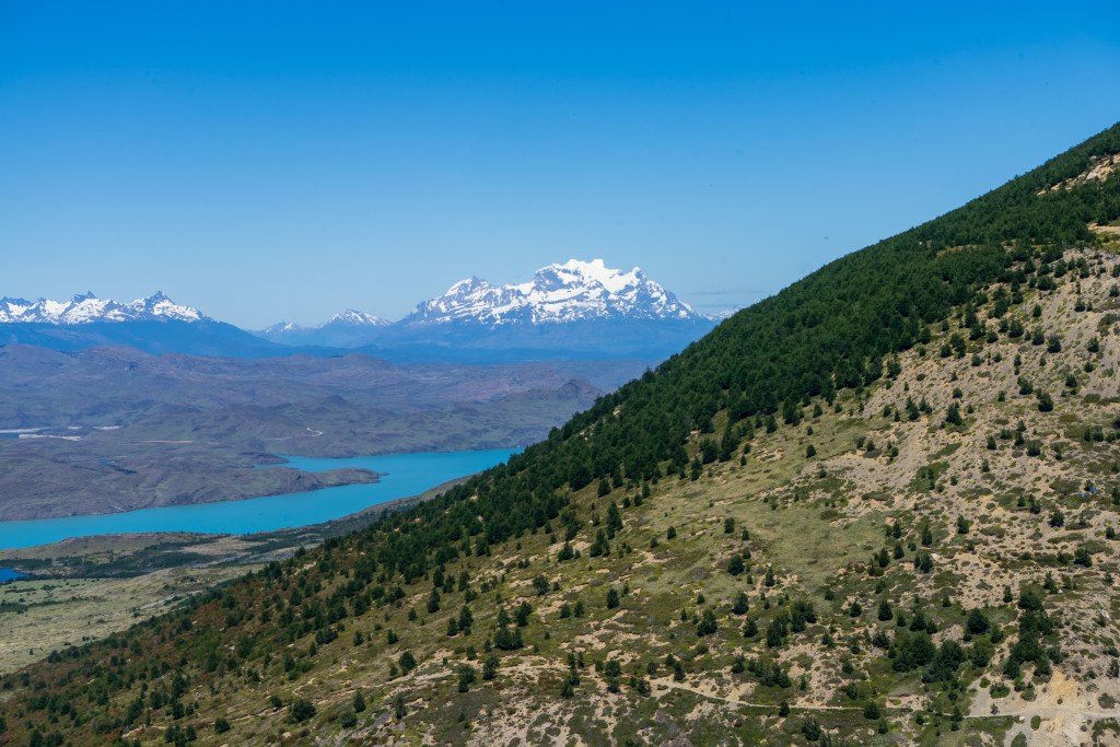
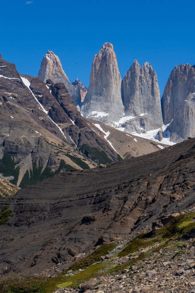
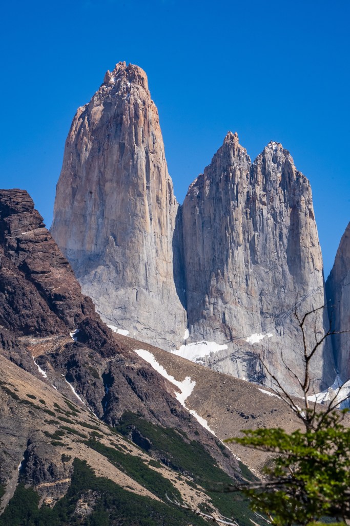
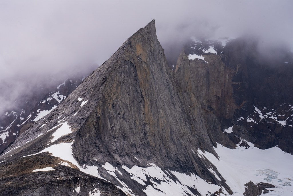
Because of the ranger’s strike there were many rumours about the access to the towers. Unwilling to risk not making it and on good info from someone who’d done it the day before, myself and two others decided to hike Cerro Paine instead of the regular trail to the base of the towers. Cerro Paine is the peak opposite the towers and a much steeper and less used trail leads up to a spectacular view over the towers and the lake at the bottom. We were the first people up there in the morning. A hot climb took us above the tree-line and onto red rock scree. We reached the viewpoint and decided to climb higher, another steep scramble along the edge of a snow field took us to a sharp ridge where we could see the lake in it’s entirety. Looking back over the way we came we could see for miles over the planes towards Puerto Natales. The scale of the towers was astounding. Even having seen photos I was not prepared for the imposing vertical monoliths and the bowl of trapped water at their base. It looked as it half a mountain had collapsed or exploded at some point in the distant past, leaving only these enormous fragments of the interior and exposing their ancient rock. Minds blown we descended again to the campsite where I had the rest of the day to relax in the sun before catching the bus back to town.